
Thundershowers To Bring Down Temp By 3-5°C In Odisha; Heatwave Alert Continues For 2 Dists
Bhubaneswar: The heatwave in Odisha is likely to subside with a trough running from central parts of northeast Uttar Pradesh to south interior parts of the state.
According to the India Meteorological Department (IMD), the trough is likely to trigger stormy weather conditions in Odisha and bring down temperature by 3-5°C over the next four days. “The day temperature is unlikely to witness any large change during the next 24 and thereafter gradually fall by 3-5°C during the subsequent 4 days.”
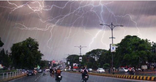
While heatwave warning continues for Jharsuguda and Sambalpur districts on March 14-15, thunderstorm accompanied by lightning and gusty surface wind speed reaching up to 30-40 kmph may also occur at isolated places in the districts of Mayurbhanj and Keonjhar during this period and again on March 17-18.
Orange warning has been issued for Rayagada, Mayurbhanj and Keonjhar on March 16, when thunderstorm accompanied by lightning and gusty surface wind speed reaching up to 40-50 kmph is likely to lash isolated places in these three districts. Light to moderate rain or thundershower may also occur at one or two places in Mayurbhanj, Nabarangpur, Keonjhar, Angul, Boudh, Kandhamal, Kalahandi, Dhenkanal, Malkangiri, Koraput, Rayagada, Balasore, Bhadrak, Jajpur, Kendrapada, Cuttack, Jagatsinghpur, Puri, Khurda, Nayagarh, Ganjam and Gajapati.
Though there is no warning after March 18, Light to moderate rain or thunderstorm may continue at one or two places in Mayurbhanj, Keonjhar, Rayagada, Ganjam and Gajapati districts during the next two days.
In the last 24 hours, 10 places in the state recorded a temperature of 38 degree Celsius and above. Jharsuguda was the hottest at 40.6°C, followed by Hirakud (40.2°C), Sambalpur (39.9°C) and Sundargarh (39.5°C). The twin cities of Bhubaneswar and Cuttack recorded 34.2°C and 34°C respectively. Moderate fog was also seen in Keonjhar.
Comments are closed.